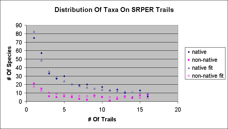
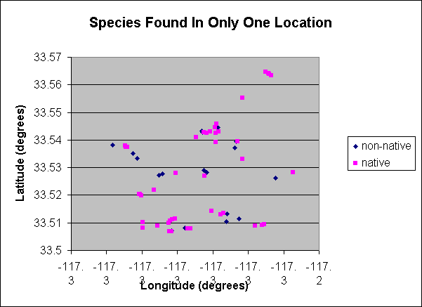
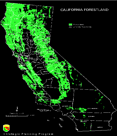
Fairy Lantern, white globe lily, Calochortus albus
grows in shady to open woodlands and shrublands

Chocolate lily, Fritillaria biflora var. biflora
grows on grassy slopes, often in heavy clay soil, often near oak trees

spotted downingia, Downingia bella; and San Diego button-celery, Eryngium aristulatum var. parishii
grows only in vernal pools

scarlet monkeyflower, Mimulus cardinalis
grows only in riparian areas (stream beds)
-------------

  • What happens when a plant finds itself in the wrong habitat or community? Consider willow weed, Polygonum lapathifolium, which grows in "moist places".

    Is a vernal pool a "moist place"?

  • 18 August 2005

  • 23 September 2005

  • --------

    Plant Communities At The SRP: My Botanical Background

    -----------

    Plant Communities At The SRP: Plant Distribution

    ------------

  • What percentage of the native taxa are found on all 16 trails?

    Just 3%, 9 out of 352.

    This is half the 6% (1/16) it would be if there was an equal probability to be found on N trails. Those 9 taxa are:

    Common NameScientific Name
    western ragweedAmbrosia psilostachya
    purple clarkiaClarkia purpurea ssp. quadrivulnera
    horseweedConyza canadensis
    blue dicksDichelostemma capitatum ssp. capitatum
    fragrant everlastingGnaphalium canescens ssp. beneolens
    California-asterLessingia filaginifolia var. filaginifolia
    Spanish cloverLotus purshianus var. purshianus
    checkerbloomSidalcea malviflora ssp. sparsifolia
    poison oakToxicodendron diversilobum

    Our two most common trees, are found on 15 routes. Coast live oak, Quercus agrifolia, is missing on the Nighthawk Loop Trail; Engelmann oak, Q. engelmannii, is missing on the Wiashal Trail.

  • What percentage are found on half or more of those 16 routes?

    29%

  • What percentage are found on only a single trail?

    20%; over three times more than if there was an equal probability to be found on N trails. -----------

  • Histogram of the number of taxa found on N trails:

  • Map of the taxa found in only a single location (black cross: native; pink triangle: non-native):

  • List of Taxa Found On Only A Single Trail Or Single Location --------

  • Why are the plants distributed in this way?

  • A fundamental law of biology: the number of species is proportional to roughly the third root of area. This is true for animals and plants.

  • It makes sense! More area allows more species to exist. The number of species cannot increase as fast as the area, since some species in the smaller area will be found in the larger area.

  • Thus the rule of thumb: if you consider an area ten times larger, you will find twice as many species.

  • Example just outside of the SRPER: common tidy-tips, Layia platyglossa ----------
  • Thus: common species are rare; rare species are common.

  • Note that there may be thousands of individuals of a rare species where it grows.

    Example: our two most common tarweeds, San Diego tarweed (Hemizonia paniculata) and sticky tarweed (Holocarpha virgata ssp. elongata), are only found on the SRP trails out of the 90 trails I've covered in Southern California. Yet our most uncommon tarweed here, slender tarweed, Hemizonia fasciculata, is found in great abundance across Southern California! ----

    ----

    What Is A Plant Community?

    ---

  • This seems a little strange to classify all the plants in an area by the few rare species that are common and dominant!

  • In fact, the concept is not fundamental:

    • Plants live where they can; they do not have any kind of relationship with the other species in any particular community. I.e., plant communities are more like the set of people at an airport hub changing planes.

    • Little predictive value in telling you anything else. I was going to hand out a list of species typical for each SRP community, but there aren't any other than the defining types! (Also, remember the species found at only one location at the SRP?)

    • No two botanists agree on the same set of plant communities

    • A given area will often be classified completely differently by different botanists

    • Some botanists argue that the concept doesn't exist.

  • However, the plant-community concept is often useful as a shorthand description of different areas of Southern California. ---

    What Is The Basis For Plant Communities?

    • Geography (slope aspects and soil characteristics) and Climate (rainfall, evaporation, and temperatures).

    • If a tree can grow someplace, it will, since trees outcompete herbs and shrubs.

    • What does a tree need to grow? WATER. LOTS and LOTS of water. Over a hundred gallons of water per day for big trees.

    • Why? To transport nutrients to the top of the tree through its vascular system. Evaporation of water at the top pulls the entire column of water and nutrients along by the force of attraction of water molecules. In order to get 1 drop of water to a leaf on the top of a tree, 99 drops of water have to be evaporated.

    • If a tree can't grow someplace, but a tall shrub can, it will. ---

    • Where can a tree get enough water in Southern California?

      • In riparian areas with enough water flow (riparian woodland);

      • In higher elevation areas where they get more rainfall (pine forests, etc.); and

      • In areas with a high water table (southern oak woodland).
      ----

    • ---

    • (Click figure for vegetation image)

    • legend for vegetation image ---

    • It is easy to understand why the basalt mesas at the SRP are grassland: the extremely-heavy clay soil rots the roots of our native shrubs and trees, which are adapted for well-drained soil on slopes.

      In addition, the soil depth is relatively shallow, and the basalt is a poor water storage rock, so there is insufficient moisture available to a shrub or tree.

      In fact, plants on the basalt are in general stunted in growth. The same species often grow twice as large on the slopes of the mesas as on the mesas. I was shocked to see my first muilla outside the SRP; it was at least ten times taller! ---

    • Most of the area recently covered by basalt still remains flat, and hence most shrubs and trees won't grow there. However, the Engelmann Oak is also called the Mesa Oak, because it has a better tolerance to its roots sitting in poorly-drained areas. Thus the Sylvan Meadows area is mostly an Engelmann Oak Woodland.

    • Oak woodland is mostly confined to the steeper slopes at the edge of the Mesas. In fact, you can clearly see the edge of the Mesa de Colorado in most places from the Vernal Pool Trail just by looking for the oaks. ---

      Plant Communities From Munz 1974 Present At SRP

      • Coastal Sage Scrub: Half-woody shrubs; precipitation 10-20 inches; California sagebrush, white sage, black sage, California buckwheat, saw-toothed goldenbush

      • Chaparral: Woodier shrubs, with well-developed broad and hard leaves; partly developed in the past by fire and many species are stump-sprouters after fire; rainfall 14-24 inches; toyon, chamise, mountain-mahogany, manzanitas, scrub oaks, Ceanothus, redberry, hollyleaf redberry.

      • Valley Grassland: Originally largely perennial bunch-grasses; now largely weedy annual introduced grasses; rainfall 6-20 inches, mixed in with the two preceding communities; many wildflowers, including Ranunculus and larkspurs.

      • Southern Oak Woodland: Open woodland, with ~15-25 inches of rain; oaks, walnut, sycamore, elderberry, sugar bush.

      • Coastal Sage Scrub is sometimes called Inland Sage Scrub when it is found away from the coast.

      • Riparian and Vernal Pool are not plant communities; they are habitats, which are very local conditions and exist in all of the above plant communities.
      ---

      Coastal Sage Scrub Vs. Chaparral

      • A huge number of species are found in both

      • California sagebrush is primarily found in coastal sage scrub (css)

      • Tall woody shrubs are found only in chaparral, due to the chaparral being in higher-rainfall areas, or areas with less evaporation (north-facing slopes).

      • These small differences do NOT mean these communities do not exist; it just means they are distinguished by only these few differences.

      • This closeness is recognized by other names for these communities: soft chaparral (=css) and hard chaparral, referring to the leaves and to how hard it is to walk through the community. ---

        Valley Grassland Vs. Southern Oak Woodland

        • Southern Oak Woodlands has trees. Why? Because those areas have enough groundwater to grow a tree.

        • How many trees does it take to change an area from a grassland to a Southern Oak Woodland? ----

          Three Different Renditions Of Plant Communities Near The SRP


          ---

          Vegetation Series

          • To get around these problems, many current vegetation classification schemes use a much-more detailed local classification, such as having ~50 types of chaparral.

          • This helps to capture the huge range of natural diversity, to help make sure that rarer elements are preserved.

          • Of course, it no longer provides a simple view into our plants!

          • Enough discussion: let's look at the SRP and see how well these plant communities / habitats work out.
          ---

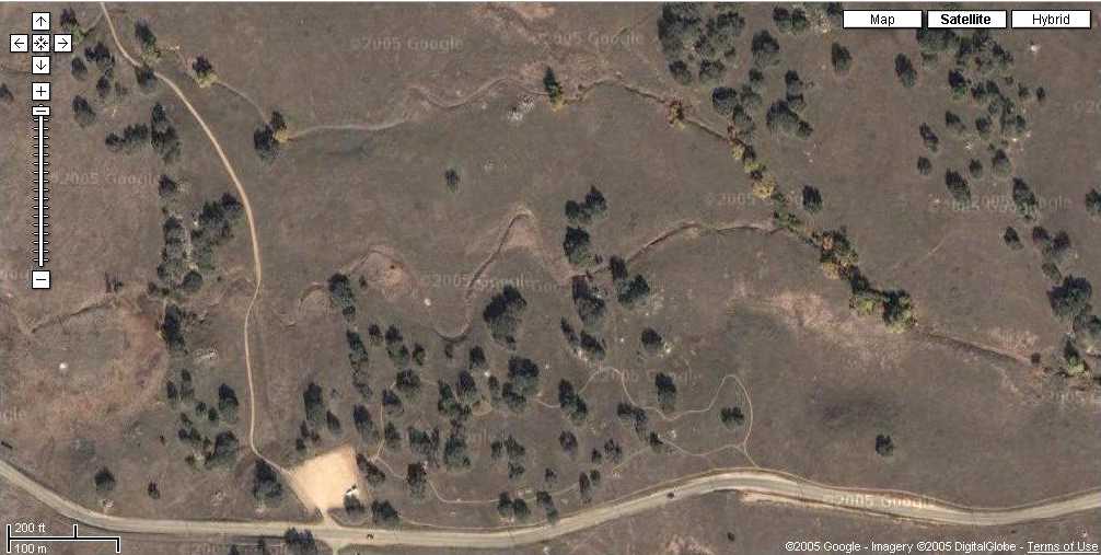
          Google Satellite Maps Of The SRP

          ---

          Topo Map Of Adobes To Mesa de Burro
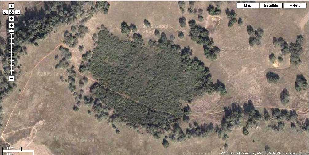
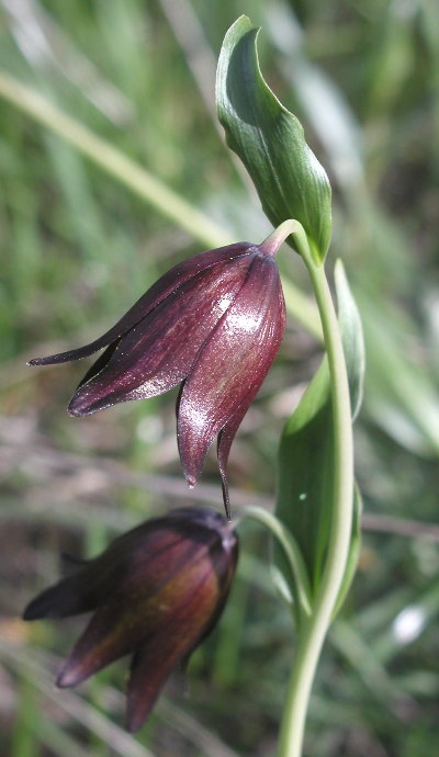
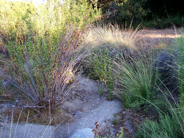
          --- --- --- --- --- --- --- -- -- -- -- --

          Vernal Pools

          • The Main Vernal Pool is arguably the top attraction at the SRP:
            • Nowhere else in Southern California can one so easily visit a vernal pool
            • It is a HUGE Vernal Pool; actually a Vernal Lake
            • It is an extremely-threatened habitat
            • It contains beautiful plants and animals, who all have amazing stories.
            • There's a beautiful boardwalk over part of the Pool, allowing you to observe the flora and fauna up close.

          • A vernal pool is perhaps the most challenging habitat for a creature. Our main vernal pool floods for anywhere from days to 6 months, yet is bone dry for months, and sometimes years, with temperatures reaching 100 degrees in the summer.

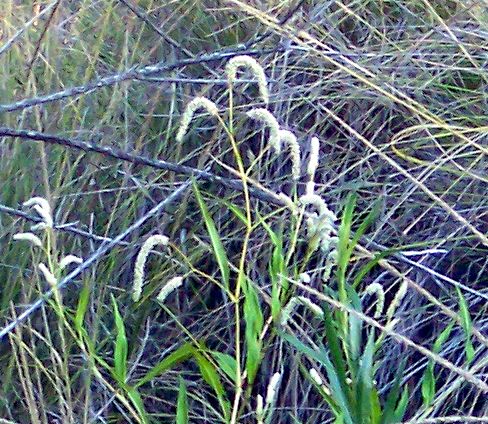
          • Vernal Pool Pictures Versus Time --

          • --

          • END PLANT COMMUNITY TALK

          • Time for a break, if we haven't had one earlier

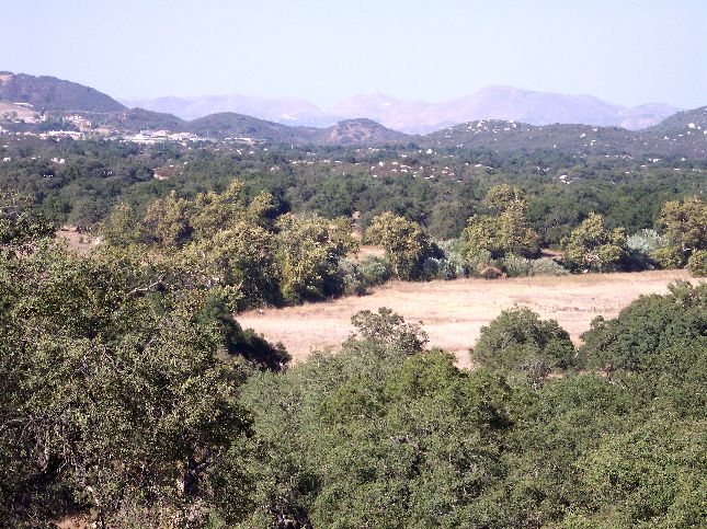
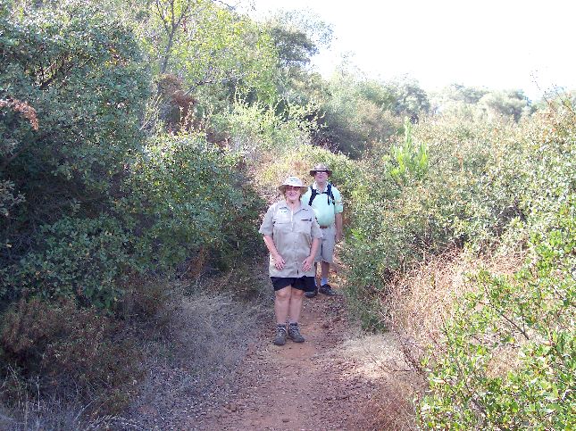
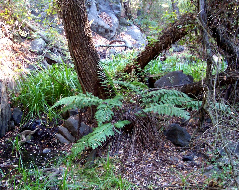
          • Pictures from Santa Margarita Ecological Reserve

          • Bonus talk after break:

            • Why are the SRP and California floras so interesting?

            • How did our plants and plant communities originate?

            • What stories does the Santa Rosa Basalt tell?
          ---

          Why Is The SRP Flora Interesting?

          • Why are the SRP and California floras so interesting?

          • How did our plants and plant communities originate?

          • What stories does the Santa Rosa Basalt tell?
          --

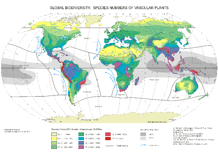
        • Global biodiversity:

          ---

        • Clearly, areas near the Equator that receive lots of rain have the highest biodiversity by far, over twice as many unique species as we have.

        • Outside those areas, the highest biodiversity is found in Mediterranean climates like ours. We have about twice as many unique species as are found in similar areas in the rest of the U.S.A.

        • What's so special about Mediterranean climates?
          • The absence of summer rainfall, coupled with good winter rainfall and a climate kept temperate by the nearby ocean, with winds from the ocean.
          • Areas with such climates in general have hugely varied topography which creates a large number of ecoregions. ("From the desert to the sea...")

        • What happened here? Why do we have such a climate? --

        • To understand why our flora is so interesting, we also need a bit of history: geologic and floral history. It's a fascinating story, and one which we can see right here at the SRP. Nowhere else in Southern California is this story told so well!

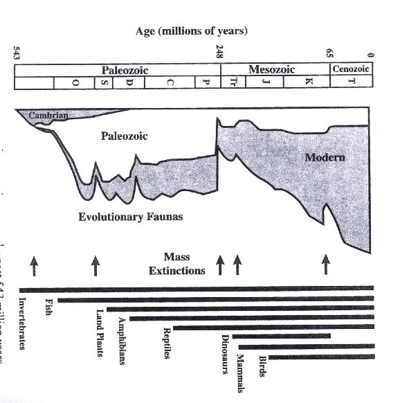
        • To understand this story, you need to know that a rough evolutionary timescale is one million years. This is roughly the time for Nature to produce a new species (although known examples range from 0.01 to 100 million years).

        • If conditions change drastically, Nature begins to adapt new species to the new conditions in one million years, and is essentially finished adapting in ten million years.

        • How do we know this? Nature has conducted at least ten or so experiments that give us the answer. They're called Mass Extinctions. --

        • The real reason dinosaurs went extinct:

          --

          --

          Plant Communities At The SRP: Geological Story

            250 Million Years Ago: Forming Pangea

          • 100 Million Years Ago: Oregon Volcanoes In Caifornia

            The base of those volcanoes is still around as the Woodson Mountain Granodiorite, the white boulders on the Boulder Loop Trail.

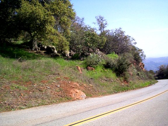
            The metamorphosed sea floor sediments is still around as the Bedford Canyon Formation, the reddish ~layered rocks on the Punta Mesa Trail and elsewhere.

          • 50 Million Years Ago: Angle of Subducting Plate Changes
            • Volcanoes move from California to Rocky Mountains
            • California becomes FLAT

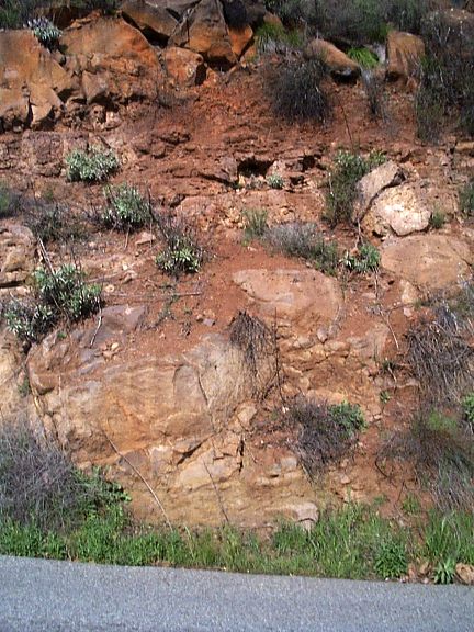
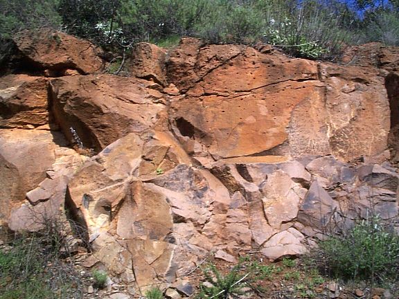
          • 30-0 Million Years Ago: overriding a spreading zone creates the Santa Rosa Basalt.

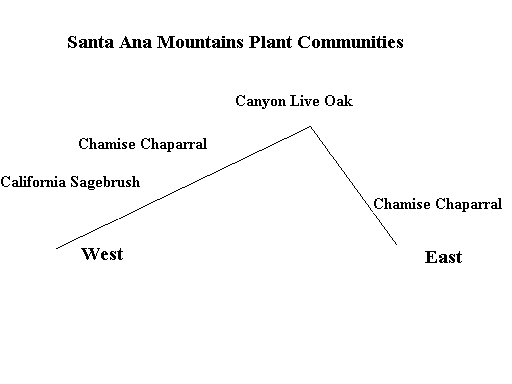
          • Elevation profiles of Santa Ana Mountains:

            Just north of Santa Rosa Plateau

            Through Santa Rosa Plateau
            --

            Plant Communities At The SRP: The Santa Rosa Basalt

            • --

            • After the Santa Rosa Basalt erupted 8-10 million years ago, the San Andreas Fault formed, the Sierra Nevada rose, and the Santa Ana Mountains were created, forming our present-day landscape.

            • The Santa Rosa Basalt kept the area dead flat in places where it still exists, and fairly flat in areas where it was only recently removed, which is why the area is now called the Santa Rosa Plateau.

            • The Santa Rosa Plateau is the only place in Southern California where you can easily see what the terrain was like 10 million years ago.
            --

            Plant Communities At The SRP: Climate Changes

            • The uplift of the Sierra Nevada altered atmospheric circulation, and Southern California lost its summer rainfall.

              Basically, when the West was flat, the airflow was zonal, meaning along latitude lines. With a solid 2 mile high barrier in place, it is easier for the westerly air currents to "go around" the Sierra Nevada then to continue zonal flow.

              We still get winter rain because the whole atmospheric circulation pattern in the Northern Hemisphere moves south in the winter, and the Jet Stream occasionally finds its way over Southern California.

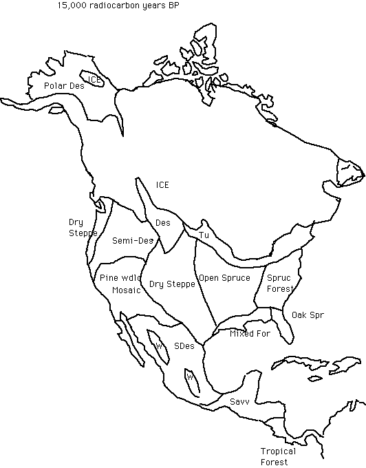
            • The climate of the Earth has been cooling since about 50 million years ago, and become really cold, with glaciers, in the last 2 million years.

            • ---

              Plant Communities At The SRP: Floral Changes

              • Vegetation in Southern California 50 million years ago: a dense tropical rainforest at the coast, with subtropical monsoonal savanna in Southern California inland. Plant densities everywhere were much higher, equivalent to the tropics today.

                Typical vegetation found in the fossil record: tree ferns, cycads, and numerous large-leaved evergreen dicots of (now) tropical and subtropical families in the coastal rainforest.

                We had in our flora trees now present in eastern North America and in Asia. The tree of heaven, Ailanthus altissima, used to be a native here!

              • 30 million years ago: Climate was cooler. Plants migrated toward coast, and were replaced by others more tolerant of coolness, like redwoods. Many species typical of the current Rocky Mountains were present here, along with species now typical of the mountains of Mexico. ---

                Plant Communities At The SRP: Floral Changes

                • 10 million years ago. Climate gets drier, we begin to lose summer rain.

                  We lose all tropical plants, which are now in Mexico and south.

                  Some plants could survive or adapt to these changed conditions, if they had the genetic variation to do so. Annuals could shorten their life cycle and shift it to winter. Perennials could slowly change their growing season from summer to spring.

                  Some of the plants previously widespread here begin to retreat to riparian (Latin ripa, banks of a river) areas, or to higher elevations where there is less moisture stress.

                  The surviving vegetation from this time is called the Arcto-Tertiary geoflora, or North Temperate Seed Plants. (Arcto: northern areas; Tertiary: the geologic period from 65 million years ago to the start of glaciation 2 million years ago.) These are true long-term California natives!

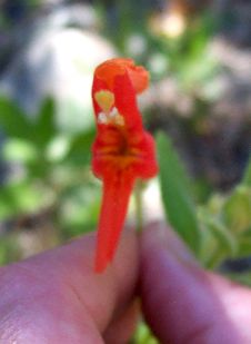
                  Examples: all willows, alders, rushes; most asters, ragweed, dodder, ranunculus, owl's clover, Mariposa lilies, telegraph weed, lupines, peony, checkerbloom, goldenrod, poison oak, viola.

                  Where do these species live at the Santa Rosa Plateau now? --

                  Plant Communities At The SRP: Floral Changes

                  • New plants come in from southern Rocky Mountains, Arizona and Mexico, called the "Madro-Tertiary geoflora". (Madro: from the region of the various Sierra Madre mountains in Mexico.)

                    These plants began to evolve ~50 million years ago when the Rockies were formed. They adapted to arid conditions in the rain shadows of the Rocky (and other) Mountains, and were able to move in as the others moved out or up.

                    Examples: manzanitas, bird's foot fern, snapdragons, locoweed, canchalagua, most lotus, sycamore(!), oaks.

                    Where do these species live at the Santa Rosa Plateau now?

                  --

                • What have our plants been busy doing the last 2 million years?

                • They've been scurrying around!

                • ---

                  Plant Communities At The SRP: Why is the Socal Flora Interesting

                  • Now we can answer the questions:
                    • "Why are the SRP and California flora so interesting?"
                    • "How did our plants originate?"

                  • We have a Mediterranean climate which is found in only five places in the world, with good winter rain but no summer rain.

                  • We have a landscape with high relief next to a coast, coupled with prevailing westerly winds, producing many different habitats.

                  • We have relict temperate North American species that have hung around.

                  • We have newcomers from dry areas in Mexico, Arizona and the Rocky Mountains

                  • Plants are local; "common species are rare; rare species are common"

                  • We have had a burst of evolution, still ongoing, from the plants being shuffled together, and shuffled around geographically during the Ice Ages. Examples: oaks, manzanitas.