Plant Species of San Jacinto Mountain:
Species That Reach Their Southernmost Location in the San Jacintos
Species That Reach Their Southernmost Location in the San Jacintos

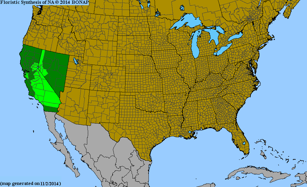
Allium burlewii, Burlew's onion | 
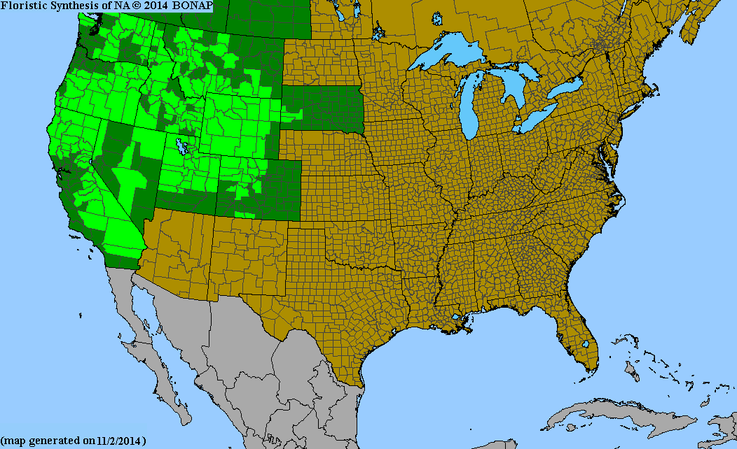
Mimulus suksdorfii, Suksdorf's monkeyflower |
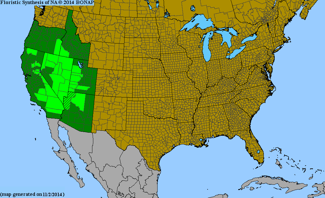
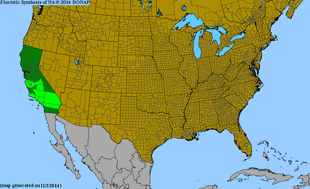
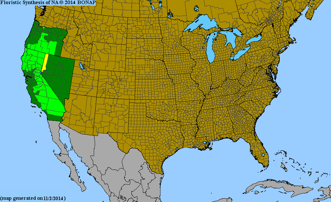
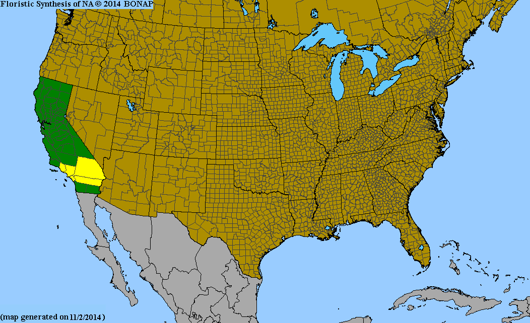
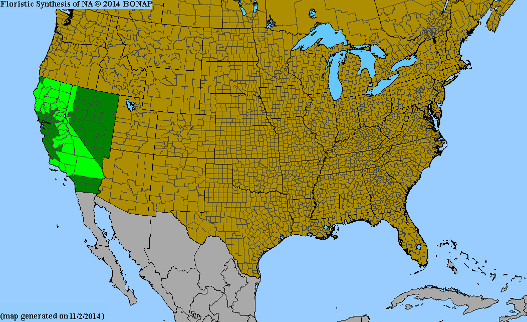
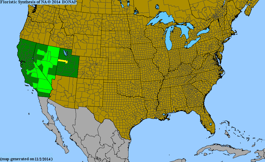
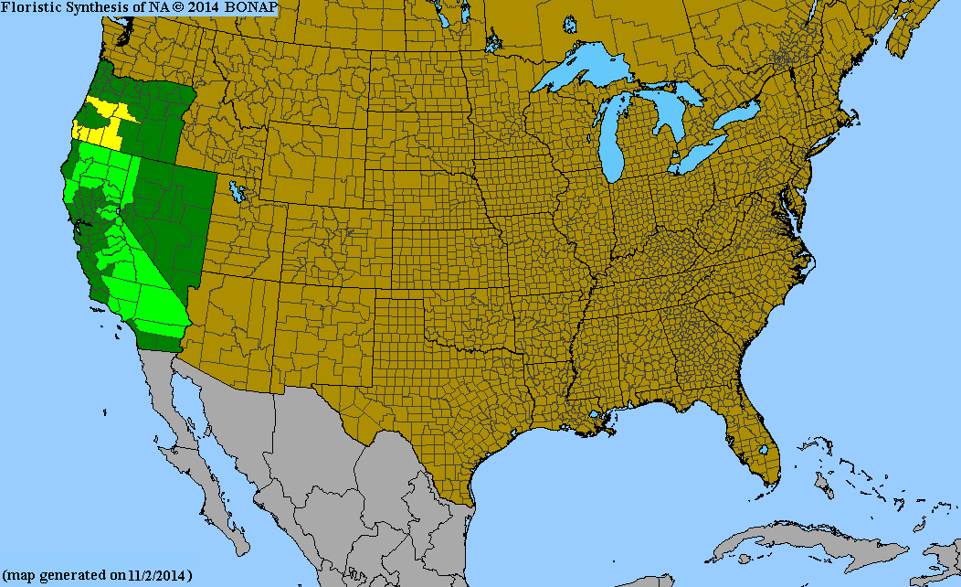
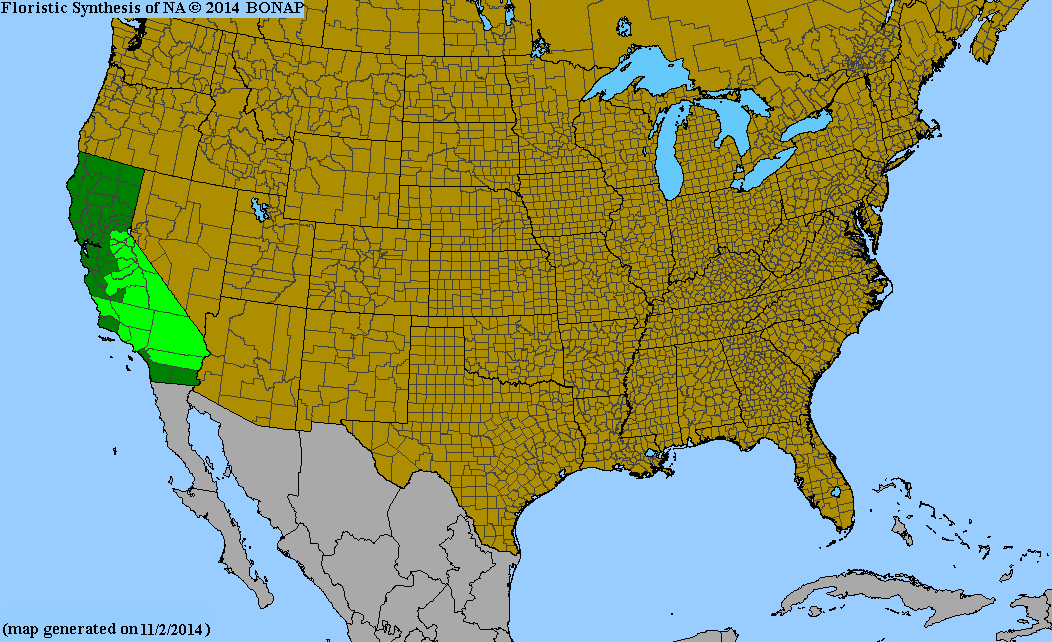
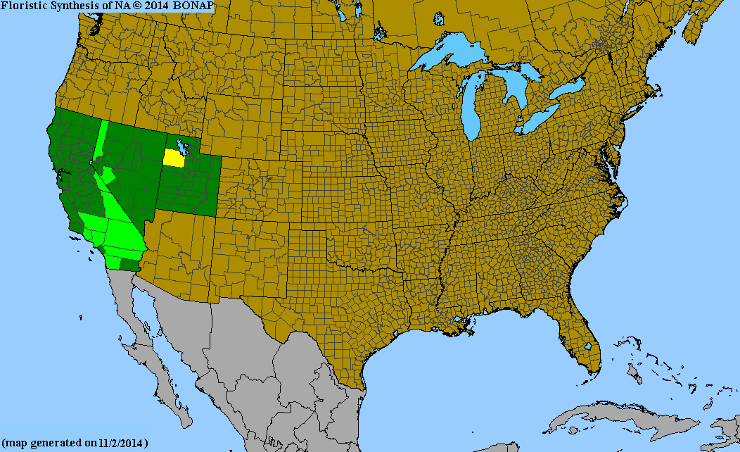
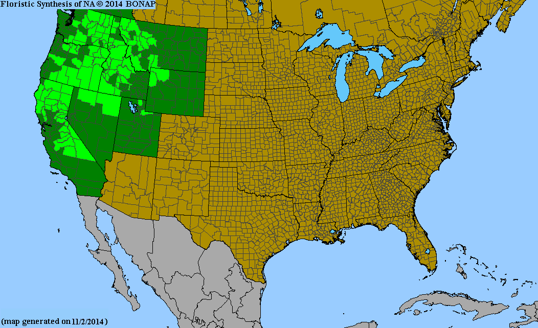
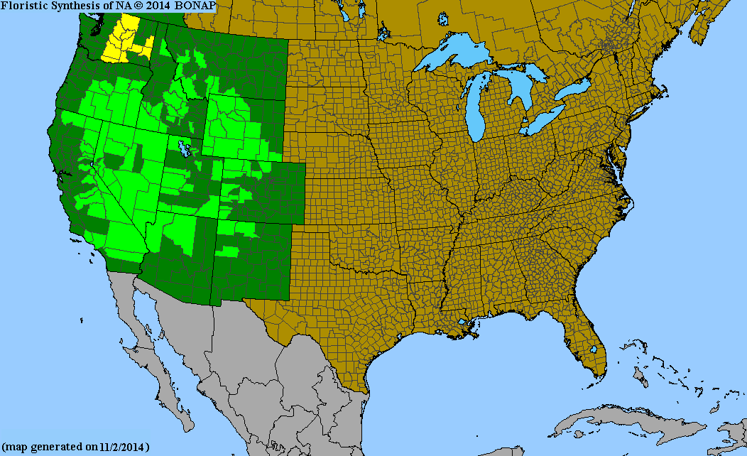
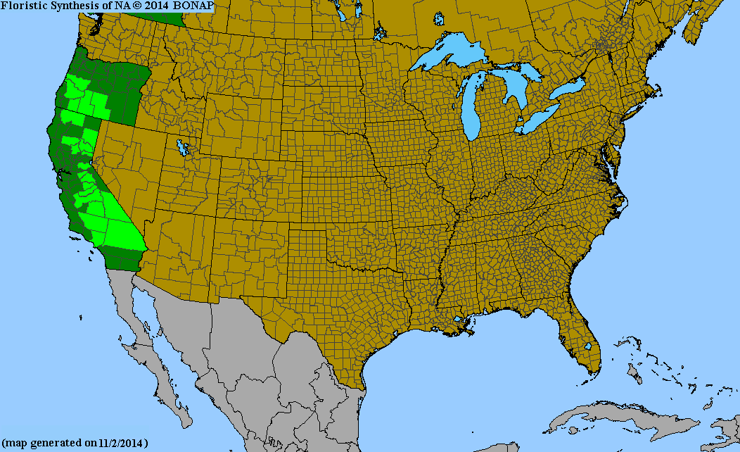
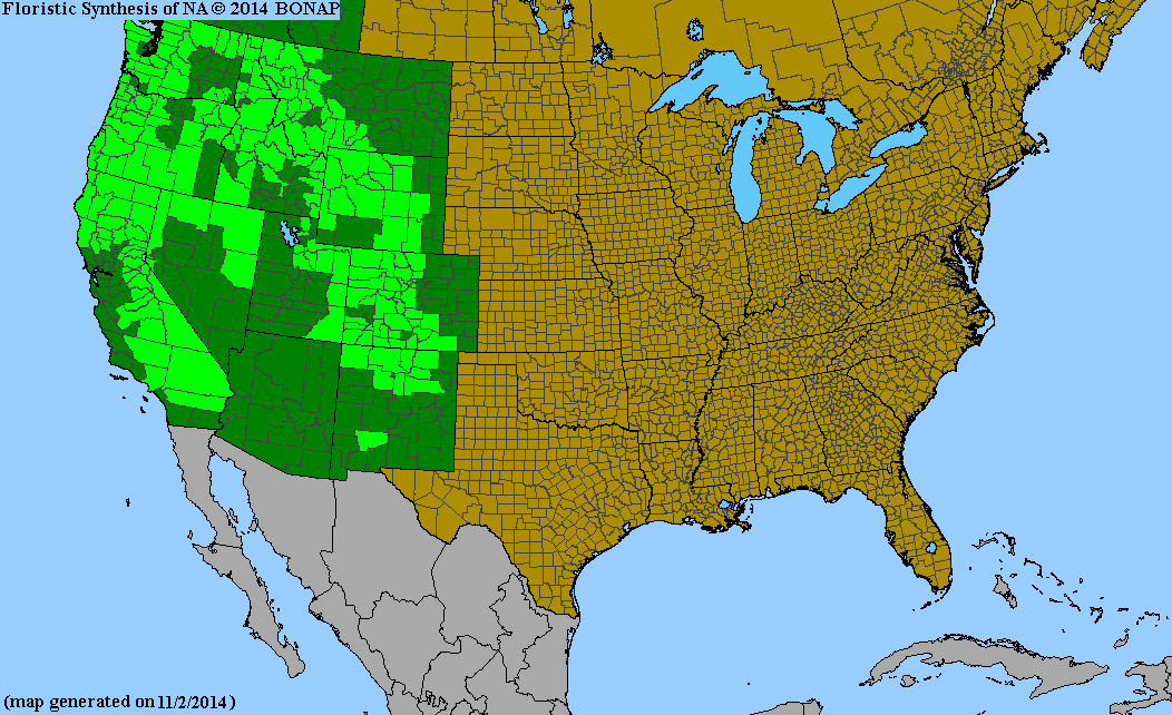
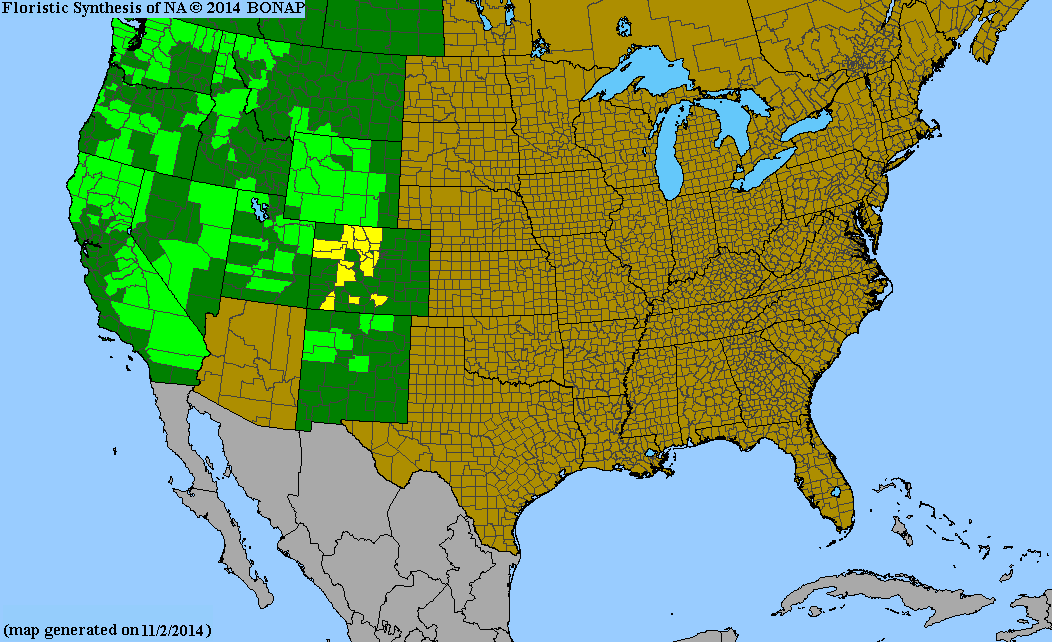
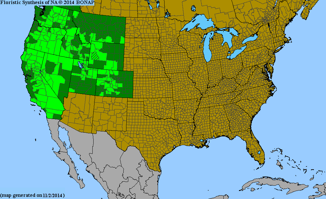
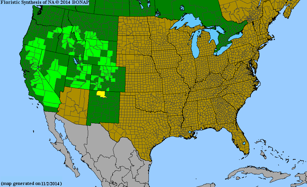
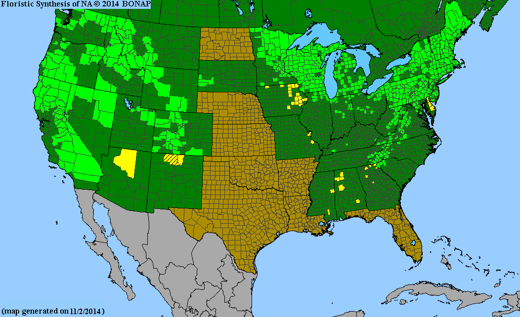
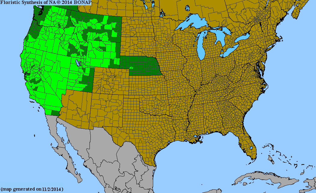
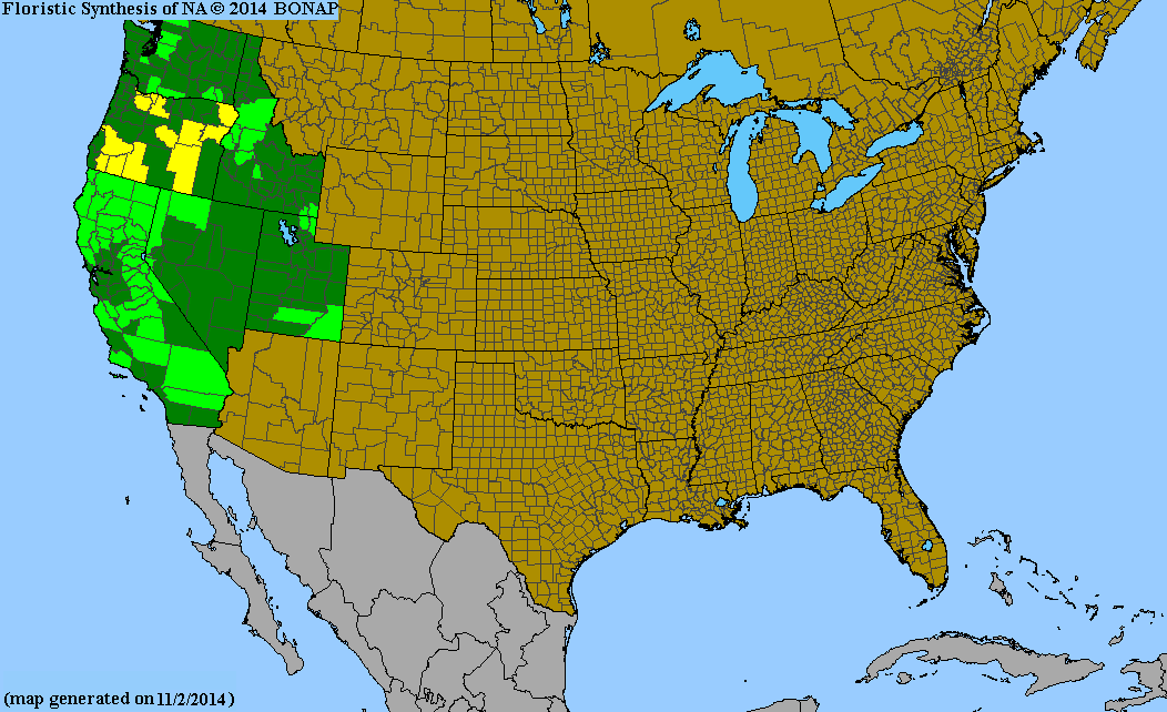
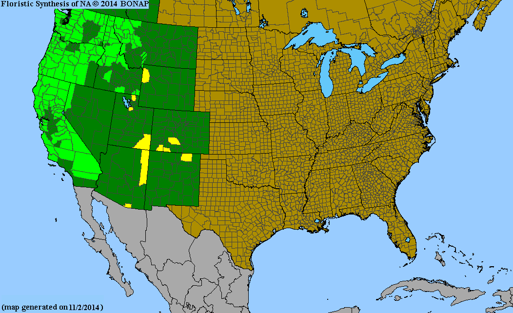
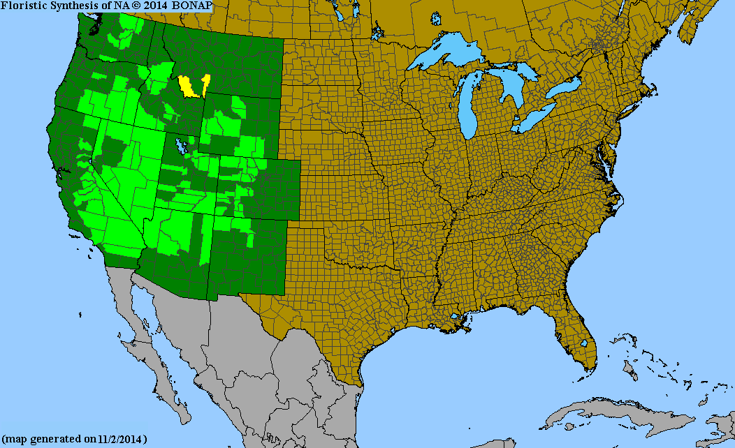
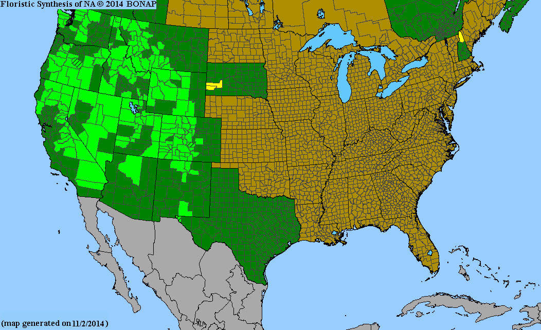
| Fig. 1. Geographic Distribution of two species that reach their southernmost location in the San Jacinto Mountains. Left: Allium burlewii, Burlew's onion, an example of a species found only in the southern half of California. Right: Mimulus suksdorfii, Suksdorf's monkeyflower, an example of a species widespread throughout western North America. Ignore the deep green color, which just indicates whether a species was found within the boundaries of a state, and concentrate on the light green color, which shows on a county by county basis where a species has been found and is not rare. The location of the San Jacinto Mountains is marked with an X, in Riverside County. Areas marked with yellow are where a given species is rare. Maps from The Biota of North American Program (BONAP). Click on the maps for larger versions. | |
It is always fascinating to see the geographic boundaries of species, and especially to analyze the boundaries of their ranges. What makes a species present at the edge of its range, and not present just outside that edge? The best way to answer that question is to examine the set of species which reach the edge of their distribution at a specific location, and try to understand what factors are important.
The San Jacinto Mountains are the northern end of the Peninsular Range that extends south through the backbone of Baja California to its southern tip, and as a result, some species reach their northernmost location in the San Jacinto Mountains. A list of those species will be presented in the future.
Because the San Jacinto Mountains are the last mountain range with elevations above 6600 feet (reaching 10,834 feet) for 200 miles south until the Sierra de San Pedro Martir, and also because the climate changes significantly to the south of the San Jacinto Mountains, the San Jacinto Mountains also have some species that reach their southernmost terminus in the San Jacintos. A list of those species is presented here.
Other species almost reach their southernmost location in the San Jacinto Mountains, but continue a bit south to one or two locations in San Diego County and/or the Sierra de San Pedro Martir. A list of those species will be presented separately.
Some species are present only in the San Jacintos, and so reach their northernmost and southernmost limits here. Those species are presented separately; see Species Endemic to the San Jacinto Mountains.
The species are presented in three tables:
- Table 1 gives the list of species that unambiguously reach their southern limit here.
- Table 2 gives the list of species that probably reach their southern limit here, but have typically a single voucher from a more southern location that is highly likely to be misdetermined.
- Table 3 gives a list of species that are also found to the east of the San Jacintos with virtually an identical southernmost latitude. For those species, it would be more proper to say that they reach their southwestern limit in the San Jacintos.
The species are presented in each table in alphabetical order by scientific name.
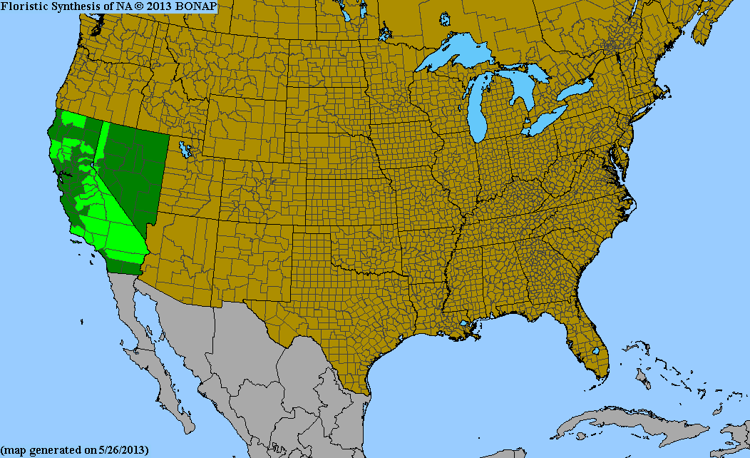
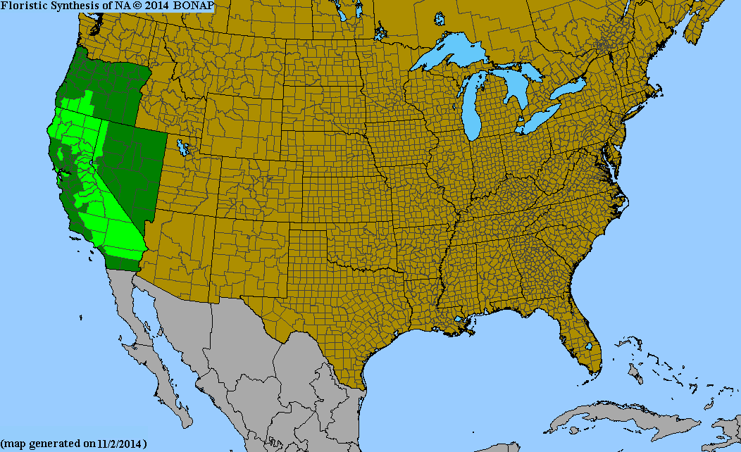
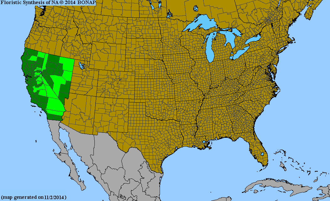
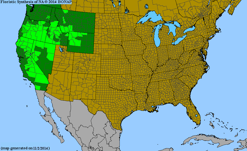
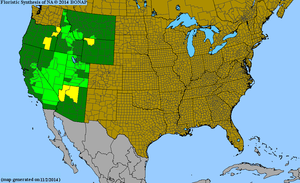
The scientific name for each species is linked to a geographic distribution map for North America north of Mexico from The Biota of North American Program (BONAP). See The Map Color Key. Note that some of these maps don't give Riverside County as the southernmost location, for species that we or others discovered for the first time in the San Jacinto Mountains since they made their maps. Those species include Astragalus lentiginosus var. sierrae, Collinsia torreyi var. wrightii, Gilia brecciarum ssp. brecciarum, Micrantha nidifica, Phacelia austromontana, Oxypolis occidentalis, and Salix lemmonii.
BONAP does not have a map for the subspecies or variety for Lupinus polyphyllus var. burkei and Penstemon grinnellii var. grinnellii, so the link goes to the map for the species.
BONAP places Trisetum canescens under T. cernuum, so the link goes to that page.
The geographic distribution in North America is characterized in broad terms in subsequent columns, which are as follows:
- CA: California endemic
- CA+N: California plus one or two neighboring states
- CA+N+N2: California plus one or two neighboring states plus a state that neighbors one of the neighboring states
- West: Widespread through the Western U.S.
- East and West: Found on both coasts of North America
Combining the species in Table 1 and 2, and including our endemic species, gives the following distribution:
- San Jacinto Mtn endemic: 11 species
- California (not San Jacinto Mountain) endemic: 14 species
- California plus one or two neighboring states: 11 species
- California plus one or two neighboring states plus one or more of their neighbors: 4 species
- Widespread throughout western North America: 16 species
- Widespread throughout North America: 1 species
Table 1. Species That Unambiguously Reach Their Southern Limit in the San Jacinto Mountains
Table 2. Species That Probably Reach Their Southern Limit in the San Jacinto Mountains
| Scientific Name (link goes to map) | Common Name | Geographic Distribution | ||||
|---|---|---|---|---|---|---|
| CA | CA+N | CA+N+N2 | West | East+West | ||
| Allophyllum divaricatum | purple false-gilia | x | ||||
| Carex hoodii | Hood's sedge | x | ||||
| Clarkia dudleyana | Dudley's clarkia | x | ||||
| Eriogonum wrightii var. subscaposum | Wright's buckwheat | x | ||||
| Helenium bigelovii | Bigelow's sneezeweed | x | ||||
| Mentzelia laevicaulis | giant blazing star | x | ||||
| Monardella australis ssp. australis | southern mountain-monardella | x | ||||
| Penstemon grinnellii var. grinnellii | Grinnell's beardtongue | x | ||||
| Poa bolanderi | Bolander's blue grass | x | ||||
| Trisetum canescens | tall trisetum | x | ||||
The source of the ambiguity for each of the species in Table 2 is as follows:
- Allophyllum divaricatum SD Agua Tibia voucher is probably of A. glutinosum, since Banks only found A.g. at Agua Tibia
- Carex hoodii Voucher from Cuyamaca Mtn is misdetermined; the duplicate of that voucher is determined as C. densa
- Clarkia dudleyana CLARK voucher from Julian is probably C. bottae; C. dudleyana is not in San Diego County Checklist.
- Eriogonum wrightii var. subscaposum Thorne voucher from Baja is probably misdetermined to variety; there are five other varieties in Baja
- Helenium bigelovii SD voucher is misdetermined H. puberulum
- Mentzelia laevicaulis Soboba Indian Reservation voucher is southernmost, from western base of San Jacinto Mountain; Another voucher from near Chiriaco Summit might be a waif)
- Monardella australis ssp. australis One voucher from Baja? Not given as being in Baja in Burge et al
- Penstemon grinnellii var. grinnellii San Diego County voucher is probably misdetermined Penstemon spectabilis
- Poa bolanderi One voucher from mexico determined as “Poa aff. bolanderi”; not given as being in Baja by Burge et al
- Trisetum canescens One AZ location with suspicious voucher
Table 3. Species That Have their Southern Limit in the San Jacinto Mountains in California With a Similar Southern Limit in States to the East
| Scientific Name (link goes to map) | Common Name | Geographic Distribution | ||||
|---|---|---|---|---|---|---|
| CA | CA+N | CA+N+N2 | West | East+West | ||
| Gayophytum decipiens | deceiving gayophytum | x | ||||
| Oxyria digyna | alpine mountain-sorrel | x | ||||
| Polystichum scopulinum | mountain holly fern | x | ||||
| Salix lutea | yellow willow | x | ||||