Coyote Creek Drainages near Henderson Canyon Road Flower Fields
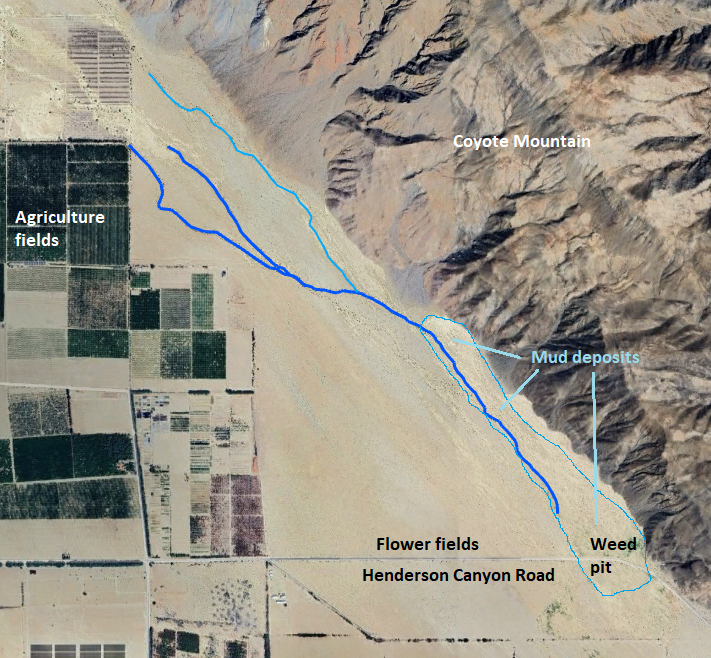
Fig. 1. The main drainage channels of Coyote Creek on the southwest side of Coyote Mountain near the Henderson Canyon Road Flower Fields. The main channels in 2025 are traced with heavy blue lines, with a secondary channel in the northern half of the pix traced with a lighter blue line. There are many braided channels in the area in the southern part of the map outlined in very light blue, marked as "Mud deposits", with only the main channel in December 2025 traced with the heavy blue line. Near the road, at the south end of the mud deposits, is a "weed pit" composed mostly of non-native plants.
When the Henderson Canyon Road Flower Fields made their latest appearance in late November 2025, the authors were intrigued as to whether water flow from Coyote Creek was at least in part responsible for those flower fields. The flower fields here seem remarkably consistent in years in which they are present, and usually, but not always, seem to outshine other places in the Borrego Springs area.
In December 2025, the authors decided to find out. We made three trips in that month to explore the area, with the last two devoted to mapping the various channels of Coyote Creek. Our final map of the channels that carry water is given in Fig. 1.
Our initial guide was the USGS Topo Map, which marked various drainage channels, one of which led directly to the Flower Fields. That made it plausible that water flow from Coyote Creek might provide surface water, or perhaps ground water, to enhance the Flower Fields; see Fig. 2.
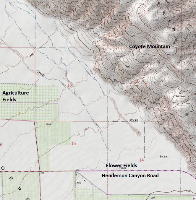
Fig. 2. The 1974 USGS Clark Lake Topo Map showing "blue line" main drainage channels of Coyote Creek on the southwest side of Coyote Mountain.
What we found on the ground did not correspond in general to the drainages in the USGS Topo Map! We found drainages with flowing water that didn't correspond to any drainage on the Topo Map, and we found dry minor washes where there were blue line drainages on the Topo Map. In particular, the blue line drainage ending just north of the Flower Fields was found to be a very minor wash that clearly had no flowing water from Coyote Creek for decades, if ever.
The inconsistencies went away when we finally used Google Earth to compare our field observations with satellite imagery.
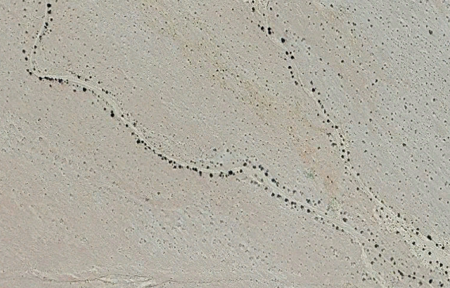
The drainages we mapped in 2025 are easily seen in the Google Earth images from the happy shrubs that are present along the channels, as well as the barren channels themselves in some parts of their length. Fig. 3 shows one example.
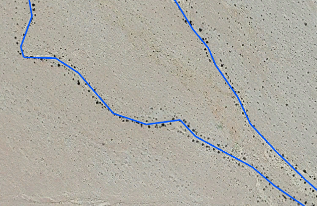
Fig. 3. Zoomed Google Earth view of two of the Coyote Creek drainages shown in the upper left portion of Fig. 1 just east of the label "Agriculture fields". See also view without the blue lines.
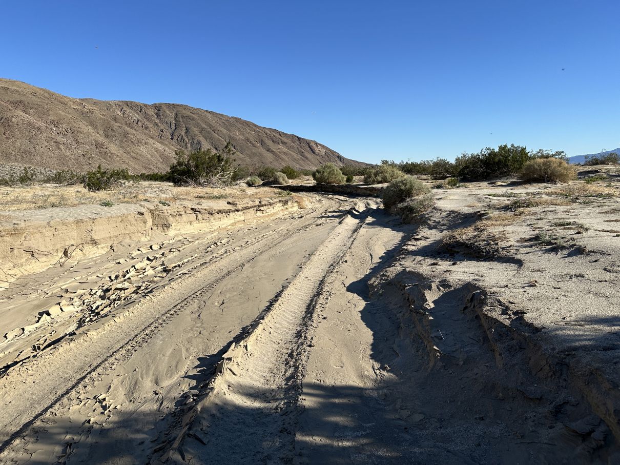
The southern drainage seen in Fig. 3 is especially easy to trace, since it is typically 10 to 20 feet wide, and is incised over nearly its entire length by two to three feet. When we traversed it in December 2025, it had ~10 foot wide dried mud in the channel over most of its length, and had unfortunately been driven on by an unauthorized vehicle; see one example.
When we overlaid the drainages (red dotted lines) from the Google Earth map on the USGS topo map, it showed that small parts of the USGS drainages align with our final map, but most do not.
We don't know for sure why there are such differences, but some possibilities are:
- Additional agriculture fields were developed since 1974, which undoubtedly modified the Coyote Creek drainages shown on the 1974 map.
- Most of the Coyote Creek drainages in this area are shallow, possibly making it difficult to draw the drainages accurately from aerial maps.
- Due to the shallowness of most of the drainages, they could easily have shifted naturally, with some shifts possibly influenced by the modifications made to the drainages in the Agriculture fields.
Our mapping allowed us to unequivocally conclude that water flow from Coyote Creek has nothing to do with the displays sometimes present in the Flower Fields.
In addition to learning that there is no water flow from Coyote Creek to the Flower Fields, we saw what actually happens in areas here that receive water flow from Coyote Creek:
- No plants grow in the channel itself where the water flows. The flow itself erodes the channel bottom, and then deposits a thick layer of mud as the flow diminishes. The mud curls up as it dries, making a very inhospitable surface for plant growth.
- In areas where the water spreads out while the creek is still flowing at high speed, the creek drops sand mixed with mud over large flat areas, and few plants grow in that cement-like mixture.
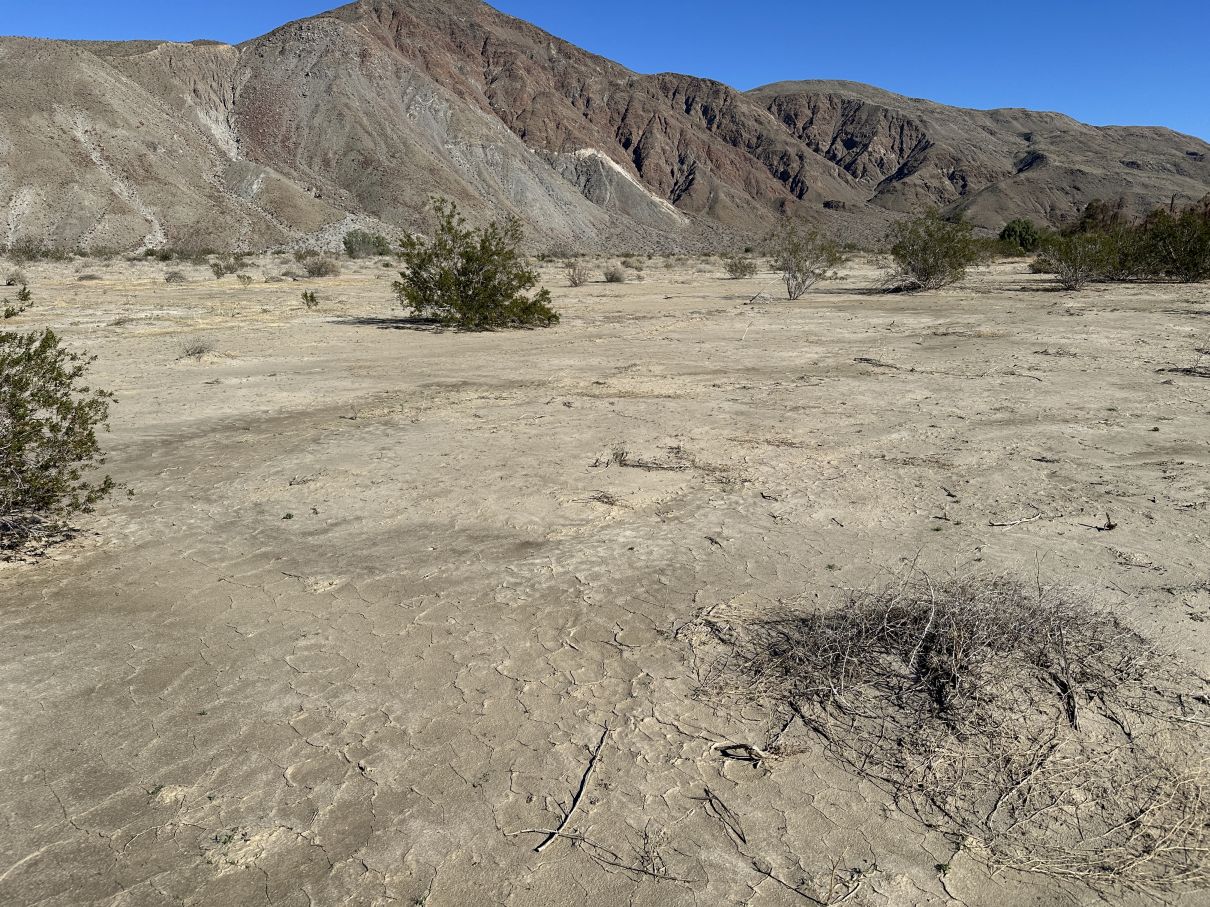
- In areas where the slow-moving water finally soaks into the ground in moderate amounts, extensive layers of mud are deposited, with very little native plant growth in the mud. Those mud layers also curl up when they dry.
- In areas where the slow-moving water continues after depositing some of its mud, only non-native plants thrive under those conditions, since we have few or no native desert plants that can stand those conditions. This accounts for the extensive weed pit at the eastern end of the straight section of Henderson Canyon Road, at the end of the "Mud deposits" section shown in Fig. 1. That area is dominated by Sisymbrium irio, Brassica tournefortii, Chenopodiastrum murale, Amaranthus albus, Amaranthus blitoides, Phalaris aquatica, and Schismus barbatus.
Fig. 4 gives examples of the above.

| 
|

| 
|
| Fig. 4.
Top left: Photograph taken on 8 December 2025 of an area where water was spreading out and sinking into the ground on 23 November 2025. On 23 November 2025 we were stymied in continuing east by the large areas of mud here, and had to retreat west where we could cross an area where most of the water was still in a channel. Top right: Photograph taken on 5 December 2025 of an area below Zeroth Crossing (where Coyote Creek crosses Coyote Canyon Road 0.6 miles north of the end of the pavement of Di Giorgio Road) where the sand / mud spread across a large area, just north of orchards. Bottom left: Photograph taken on 8 December 2025 of an area where most of the mud had previously been deposited, leaving less mud and more water, which allows non-native weeds to grow. Borrom right: Photograph taken on 8 December 2025 of a vast field of London Rocket, Sisymbrium irio, at the north end of the "Weed Pit" just north of the east end of the straight portion of Henderson Canyon Road. The location of each pix is shown on this Google Earth view. Click on the pictures for versions showing a larger area. | |
In contrast, the wonderful flower display in the Flower Fields is simply caused by September monsoonal rain falling on the sand-duney area there. The three species responsible for most of the flower display love that habitat: dune evening primrose, desert sand verbena, and hairy desert sunflower (Oenothera deltoides, Abronia villosa, and Geraea canescens). Note the reference to the sandy habitat is in the common names for two of them! There are a number of other sand-duney areas through ABDSP that also produce similar displays when they get September rain, and none of those have a major creek like Coyote Creek near them.
If you are wondering whether ground water might play a role in the Flower Field display, we dug holes 12 inches deep in December, and found only wet sand, not water in the hole. The over 12 inches of wet sand is naturally explained by the 2.4 inches of rain received this season there. Although in the past ground water was almost surely closer to the surface, the top of the ground water table in 2010 was at 420 feet elevation, 200 feet below the ground surface at 620 feet.